
Colorado Territory
Colorado became a territory in 1861 after gold was discovered on the Front Range in 1859. The territorial government quickly designated several counties, but as the Civil War was ramping up, the mountainous lands in the western part of the new territory were not well known or surveyed. All southwestern Colorado was dumped into one big county called Guadaloupe on November 1, 1861. Maybe someone realized their spelling error and the name was changed six days later to Conejos (rabbit in Spanish) County.
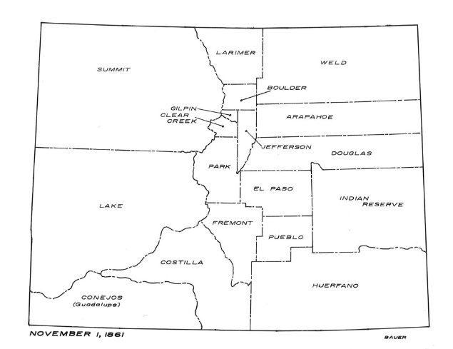
Map of Colorado's counties in 1861.
In the southwest part of the new county, there were three main areas where miners and settlers were encroaching. In the north, the Little Giant Mine in Arrastra Gulch was prospering around the camps of Howardsville and Eureka. In the Animas Valley, farmers and ranchers were settling along the river north and south of the new settlement of Hermosa. To the west in the La Plata Mountains, miners and ranchers were hoping to make their fortunes.